If you are interested in harnessing the power of a ship positions API, look no further than this article.
The maritime industry plays a vital role in global trade and transportation, with ships serving as the primary mode of transporting goods across the world’s oceans. To ensure smooth and efficient operations, ship tracking has become a crucial aspect of the maritime industry. Ship tracking APIs (Application Programming Interfaces) have emerged as powerful tools that provide real-time data on ship locations, routes, and other valuable information.
One of the key advantages of using a ship positions API is its speed. A well-designed and optimized ship-tracking API can provide real-time data on the location and status of ships with minimal latency. This allows websites and apps to display up-to-date information on ships’ movements, which is crucial for tracking shipments, optimizing routes, and ensuring timely deliveries. Fast API responses also enable applications to quickly process and analyze data for business intelligence, operational planning, and decision-making purposes.
Another thing to consider is that a ship tracking API offers a wealth of information beyond just ship locations. It can provide data on ship attributes such as vessel type, size, speed, and destination, as well as historical data on past routes and performance. This rich dataset can be leveraged to gain valuable insights into the maritime industry, including trends, patterns, and anomalies. For example, logistics companies can use ship tracking APIs to identify the most efficient shipping routes, optimize shipping schedules, and monitor vessel performance, leading to cost savings and improved operational efficiency.
Since speed, flexibility and ease of use and integration are the most important aspects when it comes to choosing a ship positions API, we recommend Zyla’s Vessel Tracking Information API, as it excels in every aspect previously mentioned.

What Are The Use Cases For This API?
Vessel Traffic Information API is a very powerful tool that has three main ways to be operated, each mode results in different types of output, which can in turn be used to satisfy different needs:
- GET VESSEL DATA BY IMO CODE: with this mode, you need a ship’s IMO code as input, and as output you’ll get information on the ship in question, such as its location, and general information about it, such as its length, it’s maxed draught, the year it was launched, and more.
- GET CURRENT ROUTE BY IMO CODE: with this function, which also requires an IMO code, you’ll get information like the departure port and destination of a particular ship.
- GET POSITION: this function asks for a particular set of coordinates, that is, latitude and longitude, and as output, you’ll get a list of all the ships that happen to be in that area.
In the following example, we picked the cruise ship MS Queen Victoria’s IMO number (9320556) to find out where she’s headed with the second function, GET CURRENT ROUTE BY IMO CODE:
{
  "status": 200,
  "success": true,
  "message": "IMO Code 9320556 is valid",
  "data": {
    "departure_port": "As Suways (Suez) Anch., Egypt",
    "departure_atd": "ATD: Apr 13, 03:44 UTC (1 day ago)",
    "callsign": "ZCEF3",
    "flag": "Bermuda",
    "length_beam": "294 / 32 m",
    "imo_mmsi": "9320556 / 310624000",
    "navigation_status": "Under way",
    "current_draught": "8.0 m",
    "course_speed": " ",
    "arrival_port": "Napoli, Italy",
    "arrival_atd": "ETA: Apr 16, 04:00",
    "latest_port_calls": [
      {
        "port_name": "As Suways (Suez) Anch., Egypt",
        "arrival_utc": "2023-04-12T17:15:00.000000Z",
        "departure_utc": "2023-04-13T03:44:00.000000Z",
        "time_in_port": "10 hours, 29 minutes"
      },
      {
        "port_name": "Aqaba, Jordan",
        "arrival_utc": "2023-04-11T03:23:00.000000Z",
        "departure_utc": "2023-04-11T18:29:00.000000Z",
        "time_in_port": "15 hours, 6 minutes"
      },
      {
        "port_name": "Salalah, Oman",
        "arrival_utc": "2023-04-06T02:26:00.000000Z",
        "departure_utc": "2023-04-06T14:38:00.000000Z",
        "time_in_port": "12 hours, 12 minutes"
      },
      {
        "port_name": "Abu Dhabi, United Arab Emirates (UAE)",
        "arrival_utc": "2023-04-01T00:53:00.000000Z",
        "departure_utc": "2023-04-01T16:56:00.000000Z",
        "time_in_port": "16 hours, 3 minutes"
      },
      {
        "port_name": "Singapore, Singapore",
        "arrival_utc": "2023-03-21T03:07:00.000000Z",
        "departure_utc": "2023-03-23T10:34:00.000000Z",
        "time_in_port": "2 days, 7 hours, 27 minutes"
      }
    ]
  }
}
In addition to everything already mentioned, it’s important to consider that Vessel Traffic Information API allows for easy customization to suit specific business needs. APIs can be configured to provide only the required data and functionality, reducing unnecessary data transfer and processing overhead. They can also be integrated with other APIs or services to create complex workflows or enable additional functionalities. For example, a logistics company can integrate a ship tracking API with a weather API to obtain real-time weather data along shipping routes, helping them make informed decisions about route planning and vessel safety. As you can see, the data provided has a degree of accuracy that any maritime business can put to good use. You can try it out for a 7-day trial with the following instructions:

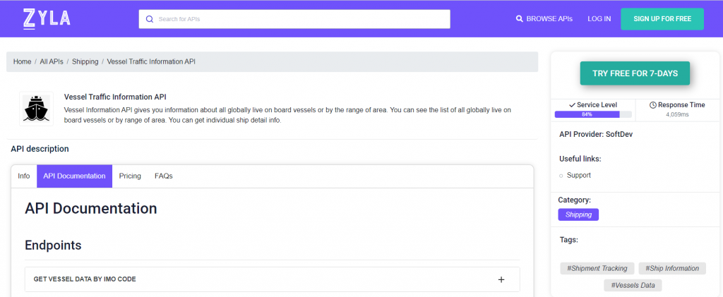
1- Go to Vessel Traffic Information API and simply click on the button “Try Free For 7-Days” to start using the API.
2- Employ the different API endpoints depending on what you are looking for.
3- Once you meet your needed endpoint, make the API call by pressing the button “run” and see the results on your screen.

