If you want to know more about the importance of a ship positions API for today’s maritime industry, keep on reading!
Tracking ships has become an essential part of maritime operations, from managing fleets to monitoring cargo shipments. With the advent of technology, using an Application Programming Interface (API) to track ships has become increasingly popular due to its ease of integration into apps or websites. In this article, we will explore the benefits of using a ship positions API to track ships and how it can streamline operations and provide real-time information.
Getting an API that checks every box is very important to stay ahead of the curve, as the maritime industry is extremely competitive, and there are more than a hundred thousand ships out there to keep track of. Luckily, Zyla’s Vessel Traffic Information API is here to make such a daunting task a breeze.
Here are three important factors to keep in mind when it comes to choosing the right API for the job:
- Real-time Data: One of the significant advantages of using a ship positions API to track ships is the access to real-time data. APIs allow for the seamless integration of up-to-date information on ship locations, routes, speeds, and other relevant data, directly into apps or websites. This real-time data helps in making informed decisions, such as rerouting ships in case of adverse weather conditions, optimizing shipping routes for fuel efficiency, or managing port operations effectively. It also enables timely updates to customers and stakeholders, enhancing overall operational efficiency.
- Customization: APIs offer flexibility in customization to suit specific business requirements. Businesses can tailor the tracking functionality to their needs by selecting specific data points or features from the API. For example, an e-commerce company can use a ship tracking API to provide real-time shipment tracking information to their customers, enhancing the customer experience. Customization options in APIs allow businesses to display ship tracking data in a way that aligns with their branding and user interface, providing a seamless and consistent user experience.

What Are This API’s Use Cases?
Vessel Traffic Information API is a very powerful tool that has three main ways to be operated, each mode results in different types of output, which can in turn be used to satisfy different needs:
- GET VESSEL DATA BY IMO CODE: with this mode, you need a ship’s IMO code as input, and as output, you’ll get information on the ship in question, such as its location, and general information about it, such as its length, it’s maxed draught, the year it was launched, and more.
- GET CURRENT ROUTE BY IMO CODE: with this function, which also requires an IMO code, you’ll get information like the departure port and destination of a particular ship.
- GET POSITION: this function asks for a particular set of coordinates, that is, latitude and longitude, and as output, you’ll get a list of all the ships that happen to be in that area.

To give an example of how this API works, here’s the output for the second option, if one would want to check the current route of the biggest bulk carrier in the world, MS Ore Brasil (IMO 9488918):
{
  "status": 200,
  "success": true,
  "message": "IMO Code 9488918 is valid",
  "data": {
    "departure_port": "Singapore Anch. 5, Singapore",
    "departure_atd": "ATD: Mar 16, 20:45 UTC (29 days ago)",
    "callsign": "VRPY5",
    "flag": "Hong Kong",
    "length_beam": "362 / 65 m",
    "imo_mmsi": "9488918 / 477913700",
    "navigation_status": "-",
    "current_draught": "12.3 m",
    "course_speed": " ",
    "arrival_port": "Tubarao, Brazil",
    "arrival_atd": "ETA: Apr 20, 20:00",
    "latest_port_calls": [
      {
        "port_name": "Singapore Anch. 5, Singapore",
        "arrival_utc": "2023-03-15T23:01:00.000000Z",
        "departure_utc": "2023-03-16T20:45:00.000000Z",
        "time_in_port": "21 hours, 44 minutes"
      },
      {
        "port_name": "Dongjiakou, China",
        "arrival_utc": "2023-03-03T18:39:00.000000Z",
        "departure_utc": "2023-03-05T22:43:00.000000Z",
        "time_in_port": "2 days, 4 hours, 4 minutes"
      }
    ]
  }
}
As you can see, the data provided has a degree of accuracy that any maritime business can put to good use. You can try it out for a 7-day trial with the following instructions:
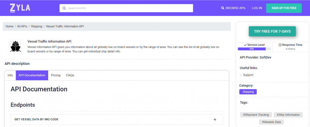
1- Go to Vessel Traffic Information API and simply click on the button “Try Free For 7-Days” to start using the API.
2- Employ the different API endpoints depending on what you are looking for.
3- Once you meet your needed endpoint, make the API call by pressing the button “run” and see the results on your screen.

